File:Orthodox parishes in Japan map.png
Jump to navigation
Jump to search
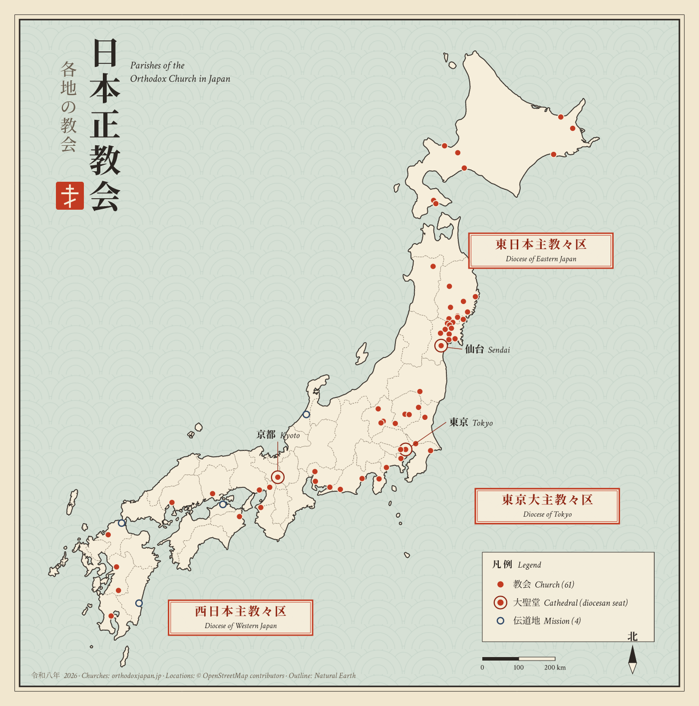
Size of this preview: 594 × 600 pixels. Other resolutions: 238 × 240 pixels | 475 × 480 pixels | 760 × 768 pixels | 1,014 × 1,024 pixels | 1,400 × 1,414 pixels.


Original file (1,400 × 1,414 pixels, file size: 1.21 MB, MIME type: image/png)

File history
Click on a date/time to view the file as it appeared at that time.
| Date/Time | Thumbnail | Dimensions | User | Comment | |
|---|---|---|---|---|---|
| current | 11:46, October 22, 2026 | | 1,400 × 1,414 (1.21 MB) | Hafvindur | == Summary == Map of the parishes of the Orthodox Church in Japan: 61 churches and 4 missions, grouped by diocese. Cathedrals (Tokyo, Sendai, Kyoto) are shown with a double ring. == How this map was made == The map was drawn by a short Perl script, not by hand and not by an image generator. The script reads geographic data and writes the SVG file directly, so every shape and dot is placed by its real latitude and longitude. # '''Outline of Japan.''' The coastline and prefecture borders come... |
File usage
The following page uses this file:
